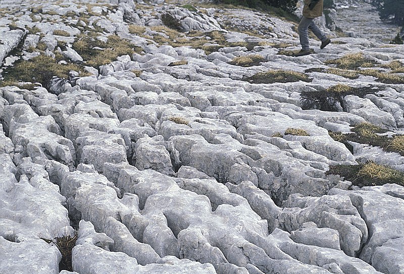
The English word karst was borrowed from German Karst in the late 19th century.[4] The German word came into use before the 19th century.[5] According to the prevalent interpretation, the term is derived from the German name for the Kras region (Italian: Carso), a limestone plateau surrounding the city of Trieste in the northern Adriatic (nowadays, located on the border between Slovenia and Italy, in the 19th century part of the Austrian Littoral).[6] Scholars however disagree on whether the German word (which shows no metathesis) was borrowed from Slovene. The Slovene common noun kras was first attested in the 18th century, and the adjective form kraški in the 16th century.[9] As a proper noun, the Slovene form Grast was first attested in 1177,[10] referring to the Karst Plateau—a region in Slovenia partially extending into Italy, where the first research on karst topography was carried out. The Slovene words arose through metathesis from the reconstructed form *korsъ,[9] borrowed from Dalmatian Romance carsus. Ultimately, the word is of Mediterranean origin, believed to derive from some Romanized Illyrian base. It has been suggested that the word may derive from the Proto-Indo-European root karra- 'rock'. The name may also be connected to the oronym Kar(u)sádios oros cited by Ptolemy, and perhaps also to Latin Carusardius.You can see that wiki says that "Ultimately, the word is of Mediterranean origin, believed to derive from some Romanized Illyrian base." However the word has full etymology in SerboCroatian. In SerboCroatian we have following words:
Rezati, Rizati, Risati - to cut, to gouge with a toothed implement
Krš - something broken
Kršiti - to break
Kresati - to break off, to chip
Krzav - something which is jagged, toothed
Krezav - someone with missing teeth, with gaped teeth
Krist, Kras - Karst
Related to karsts are dolinas.The dolina is the most representative landform of the karst surface. The name derives from the word dolina, a Slavic term indicating any depression in the topographical surface. For nearly a century, this name acquired widespread use and a well defined meaning in the international literature; as a result it is not possible to substitute it with another term such as “vrtača” or “kraška dolina”, for example, as proposed by some authors(Gams, 1973, 1974). The use of sinkhole as a synonym for doline in the American literature has also created some ambiguity, because sinkhole is mostly applied in the sense of collapse doline or of cover doline.

English Etymological dictionary says this about the English word dale:
dale (n.) - Old English dæl "dale, valley, gorge," from Proto-Germanic *dalan "valley" (cognates: Old Saxon, Dutch, Gothic dal, Old Norse dalr, Old High German tal, German Tal "valley"), from PIE *dhel- "a hollow" (cognates: Old Church Slavonic dolu "pit," Russian dol "valley"). Preserved by Norse influence in north of England.
dell (n.1) - Old English dell "dell, hollow, dale" (perhaps lost and then borrowed in Middle English from cognate Middle Dutch/Middle Low German delle), from Proto-Germanic *daljo (cognates: German Delle "dent, depression," Gothic ib-dalja "slope of a mountain"); related to dale (q.v.).Slavic word dole means down, depressed, hollowed out below the surface level, something below the place where we stand. Is this the root for all the above words. Proto-Germanic *dalan "valley" is identical with Slavic dolina "valley"...
The Slavic word dole comes from do + le = to + ground, horizontal, level...Le is another ancient root word. It is the root of the word level. I will talk about this word in one of my next posts.
Here is another example of a natural dolina, vrtača from central Serbia:

What is interesting about these landscape formations is that from their center all you can see is the edge of the hole and the sky. This makes them ideal solar observatories as I already explained in my article about rondel enclosures. There are thousands of these circular vrtača sink hole valleys strewn across Balkan peninsula.
In Slovak and Czech word vrt means to drill, a hole, a well. In SerboCroatian word "vrteti" means to spin, to turn but also to drill. This is what you do with a drill when you drill a hole, you spin it you turn it. Vrtača valleys sometimes appear suddenly and do look as if they have been drilled into the ground like this one which recently appeared in Bosnia.

Eventually the edges get smoothed up and covered with vegetation. This one looks exactly like the one I used to play in when I was a kid:

Quite often wells and lakes are found at the bottom of vrtača sink holes.


In particularly eroded karst areas vrtača sink holes accumulate the eroded soil and are the most fertile peaces of land around. This is why they are in these areas used as gardens.

SerboCroatian and Slovenian word "vrt" means garden and it probably comes from the same root as vrtača.
All this makes the areas around vrtača sink holes ideal places for human habitation in karst areas where water and arable land is scarce.
There are particular types of vrtača like depressions which are mostly perfectly circular and very shallow. They look very much like a shallow pan. These vrtačas all have stone walls built at their edges and it is very difficult to determine whether they are natural vrtača sink holes cleared and walled up by people or whether they are completely artificial man made structures. Here is one from Slovenia:

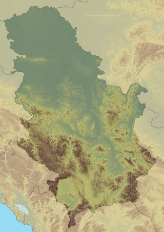
Now I would like to talk about one particular Karst region of Serbia and some of its shallow pan shaped walled vrtača structures.
On mountain Devica there are hundreds of vrtača sink holes and many of them belong to the above pan shaped shallow ones with stone circles built around them. These stone circles are of unknown origin and age as none of them was ever excavated or investigated by archaeologists. The stone circles were located very recently using Google maps after someone overheard a local forest warden telling his friends about strange stone formations he had seen on the mountain.
Here are the pictures of the two of these pan shaped shallow vrtača sink hole with the surrounding stone circle where you can clearly see the stone wall.
The first one is located on the hill called Gvozdinski Kamen (Iron stone).

The second one is located on the hill called Busarnik.

Both of these are could be natural circular depressions which people cleared of stones and then built stone walls around them or could be completely artificial. Both of them are ideal for solar observation, and could have been used for it at some stage.
But there are two more stone circles on the mountain Devica (Virgin) which are definitely completely artificial and were definitely used as solar observatories. These two stone circles are located on a plateau called "Bogovo gumno". The circles are built as walls of what looks like a pair of of natural shallow pan shaped vrtača sink hole depressions. The bigger circle is 150 meters in diameter and the smaller one is 80 - 90 meters in diameter. The depressions are perfectly circular with perfectly flat bottom and are 50 - 60 cm lower than the surrounding therein. The stone walls which define the sides of both depressions are one meter wide and is at the moment one meter high, but originally the wall could have been much higher. This is the picture of these two stone circles from Google maps with the pointer pointing at the bigger one:


What makes these two stone circles from Bogovo Gumno special, and what makes it absolutely clear that they were built and used as a solar observatory is their alignment. If you look at the alignment of the two linked stone circles on the picture below, you will see that the line connecting the centers of the two circles has azimuth 57 degrees, which means that it is aligned to the sunrise at the summer solstice. Azimuth is the angle of the sun at sunrise and sunset which may be expressed as degrees deviation from North (with East at 90 degrees). It varies by about 66 degrees over the year, from 57 degrees at the summer solstice to 122 degrees at the winter solstice. (That is, East +/- 33 degrees).

In the excellent film called "Circles on mountain Devica", Dr Aleksandra Bajić there is a great scene (starting at 6:48) taken from a helicopter flying over the Bogovo Gumno in a circle. In these scene you can see how that particular location has completely unobstructed 360 degrees view of the sky, and is therefore ideal for solar observation. Here are some stills from the film showing the location of the Bogovo Gumno complex and the four directional view from the large circle.


You can have a look at the Bogovo Gumno circles on Google maps yourself at this coordinates here.
In my article about henges and calendars I explained how henges were used for calendar calculation. In order to determine the beginning of the year, you need to determine the day of the solstice. To do that you need a sun circle, a large circle which is permanently marked on the ground. How can you permanently mark a circle on the ground? You start by marking the centre of the circle by either a stake or a standing stone. You then draw a circle on the ground using a rope and a stick. To mark the circle edge permanently, you can build a henge if the soil is soft and easy to dig deep. But if the therein is rocky, if the soil is hard stony and unsuitable for deep digging, or if there are a lot of boulders lying around, then it is much easier to just use stones, place them along the line that defines the circle and create a permanent marking by making a circular wall.
Now that you have your permanently marked sun circle, you can start observing the sunrise and sunset from the center of the sun circle. What you are actually observing is the shadow made by the central stake or a standing stone. At the sunrise and sunset the shadow will be long enough to cut the circle at the oposite end. This is extremely precise way of marking the sunrise point. This stake is in Serbian known as "stožer". This is a very interesting word which means pivot, central standing pole. The sun literally pivots around it both daily and yearly. This is a very ancient word built from stoj, staj + ga, gar, ger = standing, upright + stick, pole, stake, spear = pillar. Greeks called it "gnomon" meaning the one which knows. This was because the central stake "new" the time and date.
As you observe the sunrise through the year, you will notice that during the first half of the year, the sunrise point will move further and further to the left and the point where the first shaddow cuts the circle further and further to the right. When the sunrise point stops moving to the left or when the point where the first shaddow cuts the circle stops moving to the right and starts moving back you have found the point of the summer solstice. You mark that point in some permanent way, like with a stone which is higher than the rest of the stones which form the edge of the circle.
Now you can easily determine the day of the summer solstice every year. It is the day when the sun, observed from the center of the sun circle, rises behind the large solstice marker stone. If you mark both summer and winter solstice turning points then the point exactly in the middle between these two points marks true east. This is the point of the spring and autumn equinox sunrise. Once you have this point and the center of the circle, you can precisely mark all four cardinal directions without use of a compass.
You can read in more about how the ancient sun circles were used for calendar creation in my article about rondel enclosures and my article about calendars. Once the sun circle is built and marked it can be used basically for ever. As long as the main markers are still present the observatory is functional. All we need is the two main aligned stones, the central pillar stone and the large sun stone from the edge of the circle.
In Bogovo Gumno observatory, the summer solstice turning point, was marked with a large white stone placed in the stone wall. Observer standing in the center of the large stone circle on the morning of the summer solstice would see the sun rise behind this large white sun stone. However in Bogovo Gumno the observatory builders added another stake lying outside of the sun circle in line with the center of the large sun circle and the sun stone marking the summer solstice turning point. Then the observatory builders used this second solstice turning point marker, as a central point, stožer, around which they built another smaller stone circle. The fact that we have two stone circles linked in such a way makes it impossible for them to be built around natural vrtača sink hole depressions. The chance that two perfectly circular natural vrtača sink hole depressions would naturally appear aligned in such a way is less than zero.
Several strange observation columns built form flat stones exist around the Bogovo Gumno circles looking at the main sun stone circle. This one is aligned exactly east - west. When you look through the little opening at the top of the column you look westward across Bogovo Gumno Circle.

This is another stone viewing point aligned east - west and looking at Bogobo Gumno:

I like these next two stone "statues" viewing points because of their weirdness. I don't know if they are aligned and with what.


The astronomical complex at Bogovo Gumno is not the only man made and aligned complex of stone circles on mountain Devica.
Have a look at these three aligned stone circles on location Krst (Cross):

This very odd looking rock outcrop is called Oštra čuka:
.

Below this rock outcrop on its western side there are remains, part of the foundation stone wall, of what people believe is an ancient church which local people call the Vidovdan church, meaning the church of the summer solstice, the church of Svetovid. People from local villages still come to the place, light candle and being flowers considering the place holy and preserving the tradition. I don't have the pictures of the actual remains and would be grateful to anyone who can send them to me. But I have Google map picture of the area and what you can see on it is truly impressive. At least three aligned circles can be seen here. I have outlined the circles here just to emphasise their relationship. I didn't do drawing precisely and alignment is not exact. But it is still very obvious that the circles were man made and aligned and the whole area is definitely worth exploring.


Mountain Devica could be a huge ancient astronomical and religious center with dozens of aligned stone circles. But at the moment we just don't know.
As I said already, none of these stone circles has ever been excavated or investigated by archaeologists.
Also we might never be able to determine when they were built even if we do conduct archaeological investigation in the are, because they remained in use until very recently. We know that at least Bogovo Gumno complex was recognized as an astronomical observatory and was used as such by the local peasant population until the end of the 19th and the the beginning of the 20th century . This is when the last aligned stone, an anthropomorphic cross with a votive inscription was added to the Bogovo Gumno complex.
I will talk about this cross and its significance in my next post. This small stone cross links the Bogovo Gumno stone circles with another complex of stone circles built thousands of miles away in Ireland: the Grange circles near Lough Gur...
Thank you. This is most interesting, and of course needs more investigation.
ReplyDeleteInteresting, I need to mention that dalan is an Armenian word with the same meaning
ReplyDeleteVery interesting. Thanks for explaining the meaning of words/place names.
ReplyDelete